Bario
Primary tabs

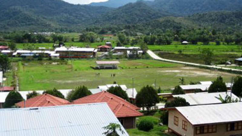
Bario is located in the centre of the Kelabit Highlands is tucked in the north eastern of Sarawak and is very close to the international border between Kalimantan and Sarawak. Bario is located on the Kelabit Highlands, 3280 feet above sea level. It is the unofficial capital of the Kelabit Highlands. Due to geographical barrier, this wonderful place is isolated from the rest of the world. Bario means ‘Wind’ in Kelabit language. (correct pronunciation is ‘Bariew’).
It is affectionately known as the ‘land of a hundred handshakes’ as this is how friendly locals will greet you as you wander around the community.
About thirteen villages are located in & around Bario area. The Kampung Bario Asal is the first and original village, and a must-visit longhouse where one can see the ancient timbers of the unique kitchen darkened by the constant smoke of generations of cooking fires.
Most of the area’s accommodation is found in and around Bario, and it is the main starting point for treks throughout the area. One can go kayaking or immerse in the historical tales of the monoliths that dot the area. The place has incredible organic food such as the famous Bario rice and pineapple. One of their annual events is the internationally known Bario Food Festival also known as ‘Pesta Nukenen’, held in July each year.

For the really adventurous; Bario is either the starting or the ending of the arduous 5/4N Bario-Ba’kelalan jungle trekking adventure.
It can get quite chilly in the evening so bring a sweater. Hot water supply is a luxury. Travel light (15kg per person) as you will be weighed in together with your luggage before boarding your flight. Confirm your return journey at the airport upon arrival if you hold a return ticket.
There are two options to Bario. A daily flight departure from Miri to Bario via MASWings Twin Otter, which is about 45 minute flight journey - dependent on weather - or by use of four wheel-drive vehicles which would take you on rugged logging road along the terrains from Miri to the Highlands and the journey takes approximately 10-14hrs dependent on the road conditions and also weather.
#bariosarawak

 The two storey solid wooden building housing the museum today was built in the year 1897 as a fort by the second White Rajah, Charles Brooke to impose peace and order in the region where warfare among the local tribes prevailed.
  The Great Cave of Niah is enormous by any measure. The floor area of the cave has been calculated at almost 10 hectares and in places the cave roof rises a majestic 75 meters above the rubble-strewn floor. It has been the site of around 40,000 years of human occupation.
 Long before Lutong bridge was constructed, the area had a ferry service, possibly at or near the site of what is now the Lutong bridge today. These pictures were taken on 4th July, 1945 during the ending stages of the Japanese occupation, by the Australian 2/13 infantry battalion aiming to reoccupy Sarawak from Japanese.