River Road
Primary tabs

admin - Tue, 10/18/2016 - 09:39
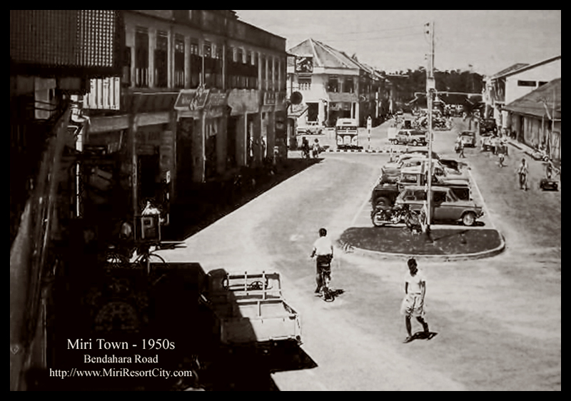
River Road was the name of the road that stretches from the Tua Pek Kong Temple, past the fish market, old bus station (now a roundabout), the old Miri Port Authority Building (now Arcadia Square), ending at the old shop houses of what is now known as the Harbour View Inn building. This road was by the Miri River and Miri Port in the 1960s.
The road is now known today as Bendahara Road, and now covers a longer distance as Miri grew, which stretches from Centerpoint all the way to the intersection at Merbau Road, after which it is known as Permaisuri Road.
These may also interest you ▾
 How the name "Woodhouse" road came to be had a very peculiar story.
  This is a problem that needs to be addressed. Please don't rely on online maps and the internet by some company from the other side of the world to determine our geography and river names.
 Resident Office & District building is a colonial-era building located alongside Kingsway that served as top government administrative office in Miri since the 1950s
 Miri Bypass Bridge is a bridge linking Permy directly to the bypass road to directly to Eastwood Industrial Area, Eastwood Golf Club, Miri Airport, or Taman Tunku. The bridge cut approximately 10 minutes of travel time from Permy area to Airport area simply by bypassing the rest of Miri via this route over the Miri River.