River Road
Primary tabs

admin - Tue, 10/18/2016 - 09:39
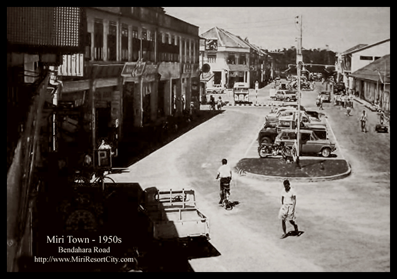
River Road was the name of the road that stretches from the Tua Pek Kong Temple, past the fish market, old bus station (now a roundabout), the old Miri Port Authority Building (now Arcadia Square), ending at the old shop houses of what is now known as the Harbour View Inn building. This road was by the Miri River and Miri Port in the 1960s.
The road is now known today as Bendahara Road, and now covers a longer distance as Miri grew, which stretches from Centerpoint all the way to the intersection at Merbau Road, after which it is known as Permaisuri Road.
These may also interest you ▾
 ParkCity Everly Hotel was a 4 Star Hotel located near Brighton beach and Marina Bay in Miri.
  The Miri District Police Headquarters is located just off Miri-Pujut Road, just off before Pelita Commercial Area.
 A curious water feature structure deep in the thick jungles of Canada Hill, which people coined "Japanese Waterfall", but could it actually be a much older Colonial times dam structure?
 Specially minted by the Royal Mint of the country in 999.9 Pure Gold and Silver 925 to celebrate the elevation of Miri to a city status.