Miri Peninsula
Primary tabs

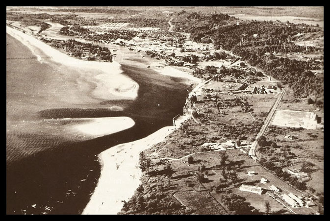 Miri Peninsula at upper right in the photo, post war. Note the sand bar at the river mouth and the Mile Long Jetty. Source
The Miri Peninsula is a piece of land that is bordered by water on three sides but connected to mainland Miri, split in between by Miri River. Spanning about 7 kilometers along the coast, the peninsula has a great history and many features and areas within.
History
Right from the beginning as a village during the 1900s, the peninsula had long been a sore point for shipping to Miri port within Miri River. The shallow sea leading up to the river required smaller transfer boats to offload any large cargo by sea, before entering the river, and even so they would have to navigate further out around the tip of the Miri Peninsula, which had very deceptively shallow sandbanks that protrude for a long distance out of the tip. This article is from the web site miriresortcity dot com - this sentence is here to prevent blatant plagarism. And if that wasn't enough, the whole process was tide dependent, which meant that at low tide only the smallest boats were able to enter the river.
To complicate river traffic, the use of the Miri Ferry crossing at the tip of the peninsula in the 1970s made for delicate maneuvering and timing for boat captains entering the river.
The Miri Golf Club was established on the peninsula in 1924 with 6 holes. Today the golf course sports a full 18 holes and covers a majority of the peninsula.
The first Miri General Hospital, built by Shell and then handed over to the Sarawak government, was located at the tip of the peninsula. The use of Miri Ferry was important for any ambulance needing to cross the river to town without using the Piasau Bridge, which was the long way around.
The Long Jetty was built and maintained by Shell Oil for easier access to offloading supply and personnel from boats, when the tides, currents or sea conditions were not favorable. It now no longer exists.
Piasau Camp, a residential area for the Shell Oil company in Miri was built along the peninsula in the 1950s and the area is filled with very serene Casuarina trees. The housing are built mostly in single story houses with a porch, while only some are double story. The area was marked for redevelopment in the late 2000s but was eventually overridden due to pressure from the public to designate the area as a Hornbill Nature Reserve, as wild hornbills are found inhabiting among the Casuarina trees and the natural environment.
The Piasau Boat Club is located on the Northern end of the peninsula, near the Piasau Bridge.
The Piasau Bridge served as a link to the peninsula from Piasau area. Originally built as a Bailey Bridge, the bridge was a secondary link in to Miri town. The Miri Ferry was the main link to town in the 1970s to 1990. The bridge marks the end point for larger boats into the river due to a height restriction.
The Lutong Airfield was located after Piasau Camp, right in front of the Lutong beach. Utilizing nearly the full width of the peninsula - which is the thickest part of the peninsula - the airstrip had a long history.
Lutong town sits at the end of the peninsula, marking the point where the the peninsula spreads out merging into the mainland as the Miri river makes a 'U-turn' along that area.
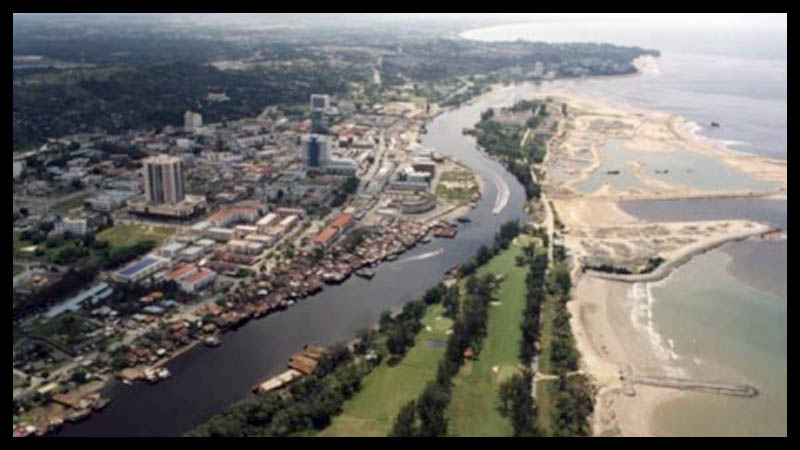
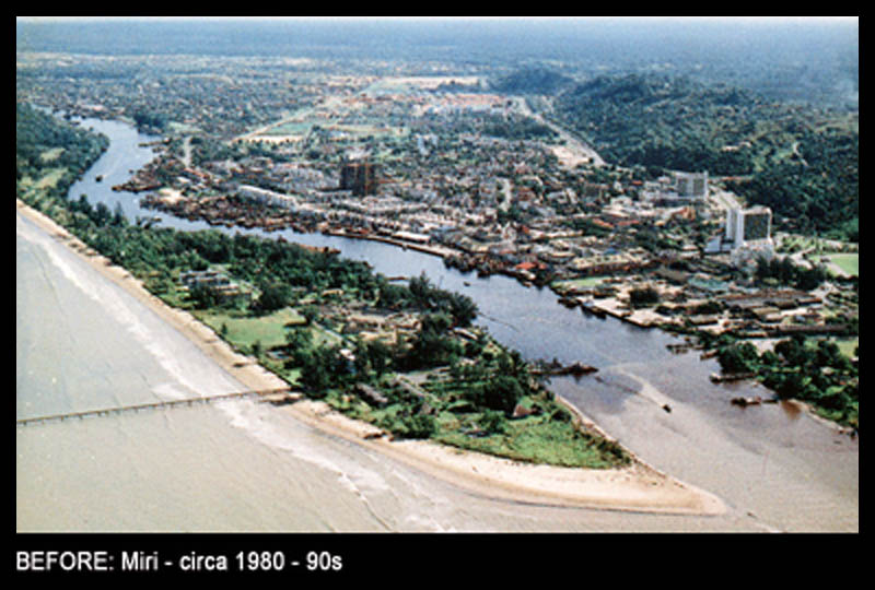
Photo courtesy of Soo Chew Studio
The river mouth was dredged many timesin recent memory, projects meant for allowing bigger vessels to enter the Miri River mouth easily. In the beginning of the early 2000s, the start of the land reclamation project meant a complete remodeling of the section of the Miri river mouth and peninsula tip. Seawalls were built, the river mouth was relocated, and a marina was constructed.
 Tomato Kueh Teow (Watanho) is another Sarawakian twist to a South East Asian favorite. Just like its cantonese fried version, the tomato Kueh Teow differs in one aspect - tomato sauce.
 Established in 1999, Curtin University of Technology is the first international branch campus of Western Austrialia's Curtin University of Technology at the invitation of the Sarawak State Government to fulfill the need for a tertiary institution of international caliber to match Miri's growth.